Independence date : April 4th 1960(former French colony)
Name of the president : Macky Sall.
Populations : 13 Millions People
Ethnic groups : Around 15 ethnic groups
Major ethnic groups : Wolof, Serer, Peulh or Fulani.
Official language : French Religion: 10 % Christian; 10 % Animists (traditional religion) ; 80 % Muslims.
Main source of income : Fishing, Tourism, Agriculture. Natural resources: phosphats, gold, iron, copper, a little off shore petrol.
Main rivers : Senegal River, Sinesaloum River, Gambia River, Casamance River
Senegal geography: Senegal area is around 200,000sq km. It is limited to the north by Mauritania, to the east by Mali, to the south by the 2 Guineas countries. The country’s western border some 700km is marked by the shore of the Atlantic Ocean, running roughly north-south. About halfway down the coast, the large cap vert peninsula juts out west into the ocean. At the end of this peninsula is Dakar, the capital city with its surrounding suburbs and satellite towns, one of the largest cities in West Africa. To the north of the cap vert peninsula, the coast faces north west and is known as the Grande cote (the great coast) stretching almost unbroken to Senegal’s borders with Mauritania . South of the peninsula is the petite cote (small coast) faces south –west which makes the weather conditions more agreeable for tourism, and this area is among the most popular for visitors. Senegal’s other important geographical features include three major rivers which all flow east to west from the Fouta Djalon highland in neighbouring Guinea Conakry to the Atlantic ocean. In the north is the river Senegal which forms the border with Mauritania. Saintlouis the old capital city is at this river’s mouth. In south -eastern Senegal, the river Gambia flows through park national of NIOKOLOKOBA (913,000ha) before entering the country of Gambia itself. In the far south is the river Casamance, which gives its name to the surrounding Casamance area, a fertile zone of forest and farmland. You will find here Senegal’s most beautiful beaches. Another major river is the Saloum River which enters the ocean via a large delta to the south of the petite cote. Senegal’s country is largely flat with a natural vegetation of dry savannah woodland. Its lies at a latitude between12 and 17 degrees north of the equator at the western end of the Sahel.
Climate: Senegal and Gambia have 2 seasons: A dry season: from October to June. (Warm temperatures: 20 to 35° in daytime, the night is cooler) A rainy season: from June to September ;( warm and wet temperatures: 25° to 40° in day time. The rainy season is characterised by short sharp tropical rain showers. After rain the weather remains always sunny and at night it’s cooler. The landscape is greener and wonderful. So SENEGAL and Gambia offer summer like holidays all the time. The coast remains always cooler thanks to the alizes (breeze blowing all over the year on the coast.)
Time: Senegal and Gambia belong to the Greenwich Mean Time zone with no time changes.
Health: No vaccinations are obligatory. However vaccination against yellow fever and malaria prophylactic are definitely recommended.
Visa: Now all foreign travelers to Senegal can obtain a free of charge tourist visa at any Senegal consulate and Embassy.Us Citizens and European Union citizens can get their free of charge tourist visa upon arrival to Dakar airport.
Feel free to contact us for any help about your visa to Senegal.
Feasts: we celebrate Muslim, Christian feasts as well as traditional feasts. National sports: wrestling
Bien au-delà d’une simple collection de jeux, casinointense propose une véritable immersion dans l’univers du casino moderne. Les guides stratégiques mis à disposition aident les joueurs à optimiser leurs sessions. Les performances mobiles restent stables même sur des appareils plus anciens. Les transitions entre les sections sont fluides et préservent le rythme de la session. L’écoute des retours utilisateurs nourrit régulièrement les évolutions de la plateforme. Les tables de blackjack live respectent strictement les règles internationales reconnues. Les méthodes de paiement acceptées sont variées et adaptées aux préférences des joueurs francophones. Les opérations limitées dans le temps créent une dynamique stimulante pour les habitués. Les machines à sous représentent l’essentiel de l’offre, avec des milliers de variantes thématiques. Les générateurs de nombres aléatoires sont audités par des organismes indépendants reconnus. Les recommandations personnalisées suggèrent de nouveaux titres en fonction des préférences de chaque joueur. L’expérience nomade est aussi complète que la version bureau, sans aucune fonctionnalité retirée. La page d’accueil met en évidence les jeux populaires et les promotions du moment. L’assistance francophone est disponible 24 heures sur 24 par chat en direct. Le chat en direct permet d’échanger avec les croupiers et les autres participants. Les délais de traitement sont communiqués de façon transparente avant chaque opération. Les jackpots quotidiens permettent de remporter des sommes intéressantes sans avoir à attendre. Les titres exclusifs disponibles uniquement sur la plateforme ajoutent une vraie valeur à l’offre. La plateforme est protégée par des protocoles de chiffrement modernes pour sécuriser les données. Le blog de la plateforme propose des articles informatifs sur les stratégies de jeu et les tendances du secteur. Le mode portrait comme le mode paysage sont parfaitement supportés pour le confort visuel. La promesse initiale tient ses engagements grâce à un travail soigné dans tous les domaines. L’ensemble des retours utilisateurs converge vers un même constat : l’expérience est à la hauteur des promesses.
Le panorama du jeu francophone s’enrichit avec l’arrivée de my stake casino et son approche moderne. Les limites journalières et mensuelles peuvent être ajustées dans l’espace personnel sécurisé. Le support technique est compétent et résout efficacement les éventuels problèmes rencontrés. Le mode tournoi crée une émulation supplémentaire entre les membres de la communauté. Les performances mobiles restent stables même sur des appareils plus anciens. Les jeux de crash et les options de paris rapides séduisent les joueurs en quête de sensations immédiates. L’authentification à deux facteurs renforce la sécurité des comptes utilisateurs. Le tableau de bord personnel centralise l’historique de jeu, les bonus et les transactions. Les sessions de roulette en direct offrent plusieurs angles de caméra pour une immersion maximale. Les opérations limitées dans le temps créent une dynamique stimulante pour les habitués. Les délais de traitement sont communiqués de façon transparente avant chaque opération. L’assistance francophone est disponible 24 heures sur 24 par chat en direct. Le programme d’ambassadeurs récompense les joueurs les plus engagés avec des avantages réguliers. Les notifications mobiles informent en temps réel des promotions et des tournois en cours. Les titres exclusifs disponibles uniquement sur la plateforme ajoutent une vraie valeur à l’offre. Les transactions sont contrôlées par un système anti-fraude en temps réel. L’ergonomie générale témoigne d’un travail de design poussé et orienté utilisateur. Les tables de blackjack live respectent strictement les règles internationales reconnues. Les conditions de mise sont précisées clairement sur chaque promotion en cours. Les dépôts sont crédités instantanément, permettant de commencer à jouer sans aucun temps d’attente. Les guides pas-à-pas mis à disposition aident les nouveaux venus à découvrir l’écosystème. Les fondamentaux sont respectés et même renforcés par des touches modernes bienvenues. La promesse initiale tient ses engagements grâce à un travail soigné dans tous les domaines.
En matière de jeux de hasard virtuels, bdmbet application offre une expérience qui répond aux attentes des joueurs les plus exigeants. Les tickets envoyés par e-mail reçoivent une réponse circonstanciée dans des délais courts. L’interface mobile a été conçue dès l’origine pour offrir une expérience fluide sur smartphones et tablettes. Les options de paiement varient selon les pays mais couvrent l’essentiel des solutions usuelles. Les options de mise progressive accompagnent les joueurs qui souhaitent monter en gamme prudemment. Les missions saisonnières incitent à découvrir de nouveaux jeux contre récompenses spécifiques. Le studio de jeu en direct fonctionne sans interruption avec des équipes qui se relaient. L’authentification à deux facteurs renforce la sécurité des comptes utilisateurs. Le mode sombre reposant pour les yeux convient particulièrement aux sessions prolongées. Les versions démo permettent de tester chaque jeu sans engager le moindre euro. Le délai moyen de réponse en chat est inférieur à deux minutes en heure de pointe. Les notifications mobiles informent en temps réel des promotions et des tournois en cours. Les bordereaux de transaction restent consultables à tout moment dans l’espace personnel. Le mode tournoi crée une émulation supplémentaire entre les membres de la communauté. Les récompenses d’anniversaire ajoutent une touche personnelle appréciée par la communauté. Les limites de mise sur les tables live s’adaptent aussi bien aux petits joueurs qu’aux high rollers. Les générateurs de nombres aléatoires sont audités par des organismes indépendants reconnus. Les filtres de recherche affinent les résultats par catégorie, fournisseur ou volatilité. Les jackpots progressifs atteignent régulièrement des montants susceptibles de transformer une vie. Le niveau d’exigence affiché par cette plateforme la positionne durablement parmi les leaders. Le souci du détail apparent à chaque écran mérite d’être souligné comme un véritable atout.
Der erste Eindruck von https://bohocasino1.net/ bestätigt sich schnell durch die Tiefe und Qualität des gesamten Spielangebots. Beliebte Klassiker wie Book of Ra, Starburst oder Gonzo’s Quest sind selbstverständlich enthalten. Bonusaktionen ohne Mindesteinzahlung erscheinen mehrfach im Jahr und sind besonders populär. Touch-Steuerung und intuitive Menüs sorgen für ein angenehmes mobiles Spielerlebnis. Die Sortiermöglichkeiten umfassen Beliebtheit, Neuheiten und Höchstgewinn. Spielerbeschwerden werden ernst genommen und transparent dokumentiert. Spieler haben die Möglichkeit, sich gegenseitig in Direktduellen zu messen. Der Live-Casino-Bereich ist klar strukturiert und nach Spielart und Anbieter sortierbar. Die laufende Weiterentwicklung lässt vermuten, dass das Casino noch lange relevant bleiben wird.
Wenn man die Optionen am Markt durchgeht, taucht https://oceanspin-de.de/ regelmäßig in Empfehlungen und Vergleichsportalen auf. Reload-Boni werden an festgelegten Wochentagen aktiviert und sorgen für zusätzliche Spielfreude. Sonderveranstaltungen werden gelegentlich live aus dem Casino-Studio übertragen. Spieler können bei Bedarf ihre eigenen Tages-, Wochen- und Monatslimits konfigurieren. Das Spielangebot umfasst mehrere tausend Titel von renommierten Software-Herstellern wie NetEnt, Microgaming und Pragmatic Play. Der Live-Casino-Bereich ist klar strukturiert und nach Spielart und Anbieter sortierbar. Selbstauskunfts- und Datenkorrekturanfragen werden datenschutzkonform bearbeitet. Ein integriertes Antifraud-System überwacht Transaktionen in Echtzeit auf Auffälligkeiten. Die Konsistenz in der Servicequalität spricht für einen seriösen Anbieter.
Gambia: Our neighbouring country is smaller (11 000 sq, km)
Population: around 2 millions people
Ethnic group: the same as in Senegal (most people speak mandica, English and local dialect)
Official language: English (Gambia was a British colony)
Main source of income: agriculture, tourism, fisheries.
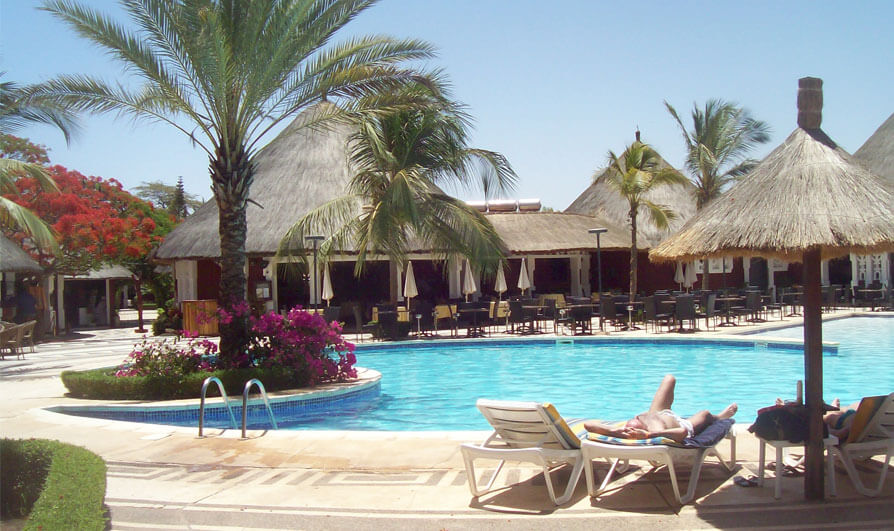
Accommodations
Hotel Neptune
Situated at the very heart of the famous Saly sea resort, NEPTUNE HOTEL welcomes you in a luxurious tropical garden.
Hotel Lamantin
Completely renovated in 2011, this resort situated in Saly and is 80 km to the South of Dakar, on the Small Coast, at the edge of a long and big beach of fair sand.
Hotel LES bougainvillees
116 air conditioned rooms set on tropical garden. Entertainment staff providing lively animation. A range of sporting activities Direct beach access Outside bars and restaurants, minimarkets, bank within easy distance Delicious cuisine.
Royam Saly
The hotel offers 120 bedrooms distributed in approximately 60 bungalows built in the African traditional style and ideally set in a lush tropical garden.
Tours
Testimonials
Gambia geography
Gambia’s national boundaries are carved by the European colonial powers at the end of the 20th century. About 300km long, but averaging only 35 km wide and is entirely surrounded by Senegal, except for about 80km of coastline. The country’s territory is determined by the river Gambia which flows into the Atlantic Ocean, dividing Gambia into northern and southern section. Banjul, the capital, is on the southern side of the mouth of the river Gambia.West of Gambia is the holiday resorts and the center of Gambia’s tourist industry.
Like Senegal, Gambia is a flat country.